
Find Addresses on Easton Streets
A useful Easton street directory method follows the property, not a supposed resident list. Enter the known address in Northampton County Public Access through Address mode, or use Map Search if the format is uncertain. Capture the situs, parcel or UPI identifier, municipality, map or block and lot clue, and deed reference. If the address does not return a match, search through the county map or parcel identifier. Apartment suffixes, historic street names, municipal boundaries, and tax versus postal conventions can prevent a simple address match.
Once the target parcel is identified, use GIS to keep its location clear, then turn to the deed index for transaction history. For a historical household, take the street and date range to Marx Room directory volumes and newspapers. Pennsylvania voter services are a personal status and polling tool, not a source for a public roster of everyone on an Easton street. This order keeps each type of evidence in its proper place.
- Search the current Easton address through Public Access or Map Search, then save the parcel and situs details.
- Use the parcel layer to view the target geography and each nearby parcel as its own record.
- Record the owner, mailing lines, deed reference, and sale information as tax and title clues, not household proof.
- Select Northampton County in Landex and follow the relevant grantor and grantee records backward.
- Use Marx Room city directories or newspaper microfilm for a particular past year and street context.
Note: County Public Access calls its tax information read-access demonstration material and does not guarantee that it is current or error-free.
Search Easton Streets by Parcel
Northampton County Public Access provides the public landing-page routes most useful for a street search: Address, Parcel, Sales, Advanced, and Map Search. The county GIS guidance gives 111 Main St. as its address-search example. Start with that plain street form before testing variants. When the site is under maintenance or an address is not recognized, the county assessment and GIS office remain a practical channel, rather than a reason to treat the property as unsearchable.
| Search label | Type | Required | Easton street use |
|---|---|---|---|
| Address | Search mode | No | Start with the street address in the county format. |
| Parcel | Search mode | No | Use a known parcel or UPI identifier. |
| Sales | Search mode | No | Check sale history after the live system is available. |
| Advanced | Search mode | No | Fields were unavailable during maintenance, so no unverified filters should be assumed. |
| Map Search | Map mode | No | Find the parcel visually when address text does not resolve. |
The Northampton GIS assessment-linked parcel layer provides the public field schema.
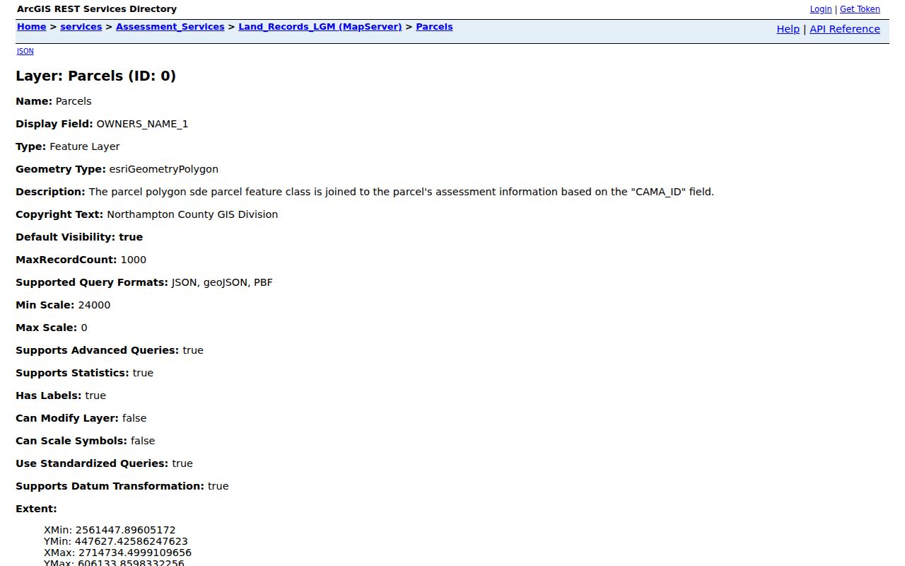
The service supports parcel-focused geography, so an Easton address can be checked before a records request goes to the wrong municipality.
Read Easton Parcel Fields
The county GIS parcel service joins assessment information through CAMA_ID and displays a substantial field set. An Easton street result can include PARCEL_ID, map, block and lot, municipality, LOCATION, deed reference, sale date and price, owner lines, three mailing lines, land-use or neighborhood codes, value fields, acreage, building facts, and program flags. The public service also permits query, pagination, ordering, statistics, and geometry operations, with a 1,000-record maximum for a broad query.
The helpful fields are not all evidence of the same thing. LOCATION is the situs, or physical property location. Owner names and mailing lines are tax-roll details. A mailing address may be a post-office box, trustee, business, or off-site contact. The field list may help join a street address to a recorder record, but neither a tax owner nor a mailing line proves current occupancy.
- Parcel or UPI
- A property identifier used in county tax-map and conveyance workflows.
- Situs address
- The location of the property, shown in the GIS
LOCATIONfield. - Plat or map, block and lot
- A mapped land reference that can keep an older Easton property tied to its legal description.
- Criss-cross directory
- A reverse address arrangement in some historical directories; confirm a particular Marx Room volume has one before relying on it.
Keep Easton Address Geography Straight
County GIS maintains tax maps and has municipal boundaries, street centerlines, address points, school boundaries, and building footprints among its datasets. This is why a postal-style Easton address should not be assumed to sit inside the City of Easton. A location in an outlying municipality can use an Easton mailing address while its permits, police, or local records belong elsewhere. Map the municipality before sending a request to City Hall or Easton Planning and Codes.
Uniform Parcel Identifiers were created under County Ordinance 159-1989. GIS Ordinance 360-2010 identifies the GIS Division as permanent custodian of county tax maps, and county procedures require addresses on subdivision plans and UPI certification for conveyances. In an older deed, lot, block, UPI predecessor, or metes-and-bounds description may be a sturdier key than the modern street number. Easton Code §285-2 also assigns the City Engineer the authority to number principal building types and new construction or subdivisions.
Follow Easton Deeds Along Streets
The Landex WebStore requires Northampton County selection before a recorder search. Its General Search can use Company or Last Name, First Name, optional Begin and End Dates, and document types such as Deed, Mortgage, Mortgage Satisfaction or Discharge, Will, and Other. Question-mark and asterisk wildcards are accepted in the name field. Instrument Search requires the county and instrument number. Book and Page Search requires the county plus both book and page, and does not accept wildcards.
From a street clue, use the parcel’s deed reference or current owner to find the recorded acquisition. Record the grantor, grantee, recording date, instrument number or book and page, and legal description. Then search the earlier owner as a grantee to locate the prior acquisition. This party-chain process is more dependable than assuming an old deed will contain a present-day street number. Initial searching is free, while Landex states a $5 processing charge per selected-document order; certified copies are the courthouse route.
The Landex Northampton recorder search shows the county-specific document-search route.
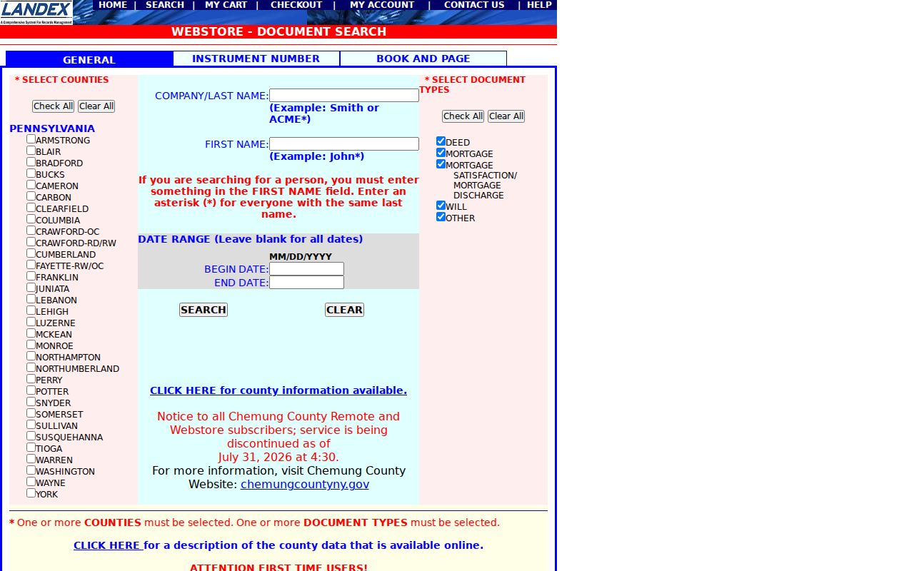
Its party and date controls are designed for recorded instruments, so the title chain should remain separate from any claim about current Easton residents.
Match Easton Street Records
Several record sets can be keyed to an Easton address, but they are not interchangeable. Assessment and GIS provide the strongest current parcel geography. The recorder provides documented transfer history. City Planning and Codes may hold project-specific material, while the Marx Room adds historical address context. A voter channel has statutory access and use limits, and should never be promoted as a general street roster. Bring the address, approximate dates, and parcel clue to each custodian rather than asking one office to answer every question.
| Easton address record | Keeper | What it shows | Access route |
|---|---|---|---|
| Tax and property roll | Northampton County Assessment | Situs, parcel, owner and mailing lines, sales and deed clues | Public Access or assessment channel |
| GIS parcel layer | Northampton County GIS | Parcel geometry, tax-map geography, property attributes | GIS service and map resources |
| Recorded instruments | Recorder of Deeds | Transfer parties, reference, legal description | Landex, public terminal, Recorder |
| Permit or code records | Easton Planning and Codes | Project or enforcement trail for an address | Department inquiry or RTKL request |
| Historic directories and newspapers | Marx Local History Room | Time-specific address and surname context | Actual volume, microfilm, or research help |
| Voter material | PA and county elections channels | Controlled civic records under state rules | Personal lookup or lawful request procedure |
For a one-person question rather than an address chain, use the more focused Easton resident lookup workflow.
Ask Easton About Address Records
City-created material follows a different channel than county tax and deed records. Easton Planning and Codes is the local desk for permit, zoning, inspection, complaint, enforcement, and plan questions. Give the street number and name, approximate time period, project or permit type if known, and the kind of record sought. The research did not locate an official public search for Easton permits or code cases. The city’s OpenGov material documents an application route with address or parcel selection, not a verified public history search.
Use Planning and Codes at 610-250-6724, visit City Hall at 123 S. Third Street, or submit a narrow Right-to-Know request. City Hall publishes hours of Monday through Friday, 8:30 a.m. to 4:30 p.m. The request form allows inspection, paper, certified, or electronic-copy choices where applicable. A property project record may show work or a permit applicant, but it does not prove a particular person lived at the address.
Note: When an Easton permit search is unavailable online, the correct fallback is a focused department inquiry or RTKL request, not a broader person search.
Trace Easton Streets in Directories
Easton street directory history lives primarily at the Henry F. Marx Local History Room, where verified city-directory holdings begin in 1855. The room also holds maps, yearbooks, family files, church and cemetery material, and newspaper microfilm dating from 1799. Take a street form and date range to staff. Inspect the volume’s title page, address section, and abbreviations. The research did not verify every annual run or a public reverse or criss-cross directory series, so confirm the actual book before expecting it to list a street by address.
The library’s digitized 1890 Census Directory of Northampton County illustrates why exact transcription matters. It pairs names with numbered addresses and sometimes adds occupation or household text. An r. marking should remain as printed unless the exact volume supplies a key. A directory entry is a contemporaneous compiled clue, not proof that every person at an Easton property lived there. Pair a year with a deed, obituary, census, or newspaper when the question needs stronger support.
Compare Easton Street Maps Over Time
Historic Easton address work needs a place-name check. The Library of Congress files its April 1904 Sanborn Fire Insurance Map under Easton and South Easton. The free set has 37 sheets. A Sanborn map can show building footprints, construction material, and use at the map date, but it does not name residents. Pair it with a Marx Room directory, recorded document, newspaper, or public census record to connect a building to people in a particular period.
No official source located a citywide Easton renumbering or street-renaming crosswalk. Do not invent one. Preserve old street spellings and the South Easton label, compare the historic building location with current GIS parcel geometry, and use lot or legal-description clues when street numbers do not align. The current county map layers offer municipal and tax-map context that helps avoid forcing an old address into the wrong present jurisdiction.
Monitor Easton Recorded Changes
Landex RecordAlert for Northampton County can monitor up to five names and five parcel or UPI identifiers for one email and phone combination. An alert reports the monitored name, recording date, instrument number or type, and municipality. It can help a property owner notice a newly recorded item connected to an Easton parcel or name. The service is an alert channel, not a title opinion or a proof of a person’s residence.
A suspicious transfer should be checked with the Recorder and the recorded document itself. The Pennsylvania Attorney General has warned about forged-transfer and property-ownership scams. Contact the official consumer-protection route if a deed-fraud concern appears. Avoid replying to unexpected messages that claim a property or tax issue without independently reaching the relevant office.
Limit the Easton Street Directory
An Easton street directory cannot supply a lawful, complete household list. Parcel ownership differs from occupancy. Mailing address differs from situs. Renters, utility customers, driver and vehicle data, and protected people are not a public street roll. Pennsylvania voter access has defined election-related use rules, and its protected-voter safeguards must be respected. The Address Confidentiality Program protects participant addresses. Court and RTKL records also exclude many sensitive identifiers and protected information.
Commercial people-finder products may contain incomplete or conflated information. They do not replace a county record, a custodian confirmation, or direct verification. When a public result conflicts with another source, keep the records separate and ask the office that controls the specific item how to obtain or correct it.